|
Customized Landscapes for Stellarium |
|
|
[May 2020]
Stellarium (web site -- https://stellarium.org/) is a free/open-source planetarium program which is handy for planning a night of observing. Stellarium runs on the major OS platforms- Linux, Mac OS, and Windows. In additiion to simply plotting stars, it allows for placing the sky above a realistic landscape. Customizing that landscape for your own environment is not hard, and handy for visualizing the sky in your position. This is particularly useful when your horizon includes obstructions such as buildings or hills. 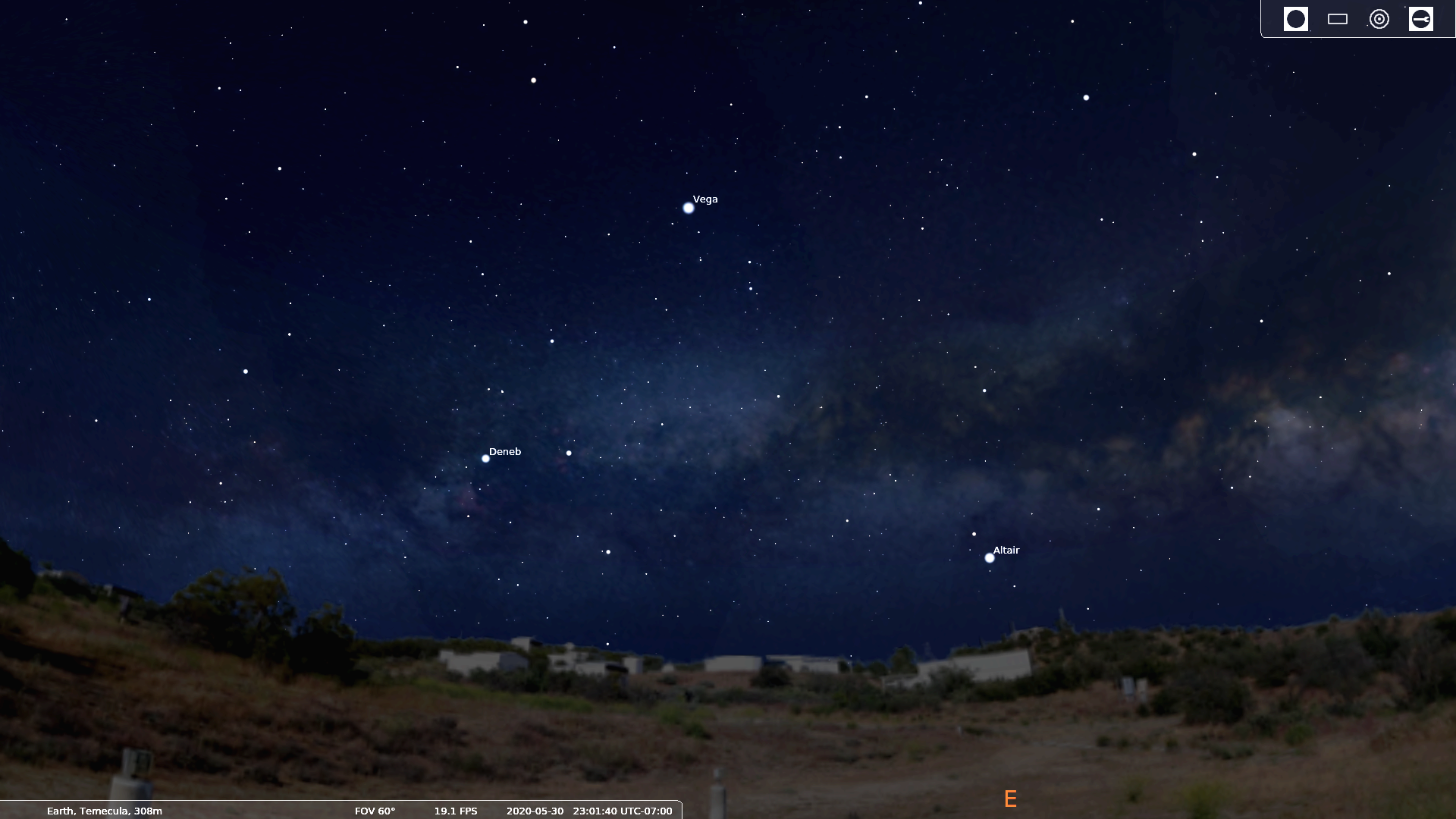
Click to enlarge. The following assumes that you are familiar with Stellarium and an image processing program. If you're an Orange County Astronomers member who is observing from from our Anza site, you can just download the files. Stellarium provides a way to add the custom landscape from a .zip file for your user account. As described below, two files - a graphic scene file (.png) and a text (.ini) information file must be in a folder in your user directory. Stellarium can handle installing these files once the .zip file has been created (or downloaded). With Stellarium open, use the "Sky and Viewing Options Window" selection from the pop-out menu on the left side. Click the "Landscape" tab and click on the "Add/Remove Landscapes..." button at the bottom of the window. Next click on "Install a new landscape from a ZIP archive", and browse to the .zip file containing a folder with the .png and .ini file. See below for a basic example set of files (location is the "football field" at the observing site of the Orange County Astronomers). If you need to install the custom landscape for multiple users on the same machine, files can be shared but administrator access willl be needed and the files will need to be manually installed (described separately). The landscape you select can be set as the default one used by Stellarium, but remember that the stars will not be correctly plotted in the sky against the landscape selected unless your latitude and longitude are also set correctly to match the location where the landscape panorama was shot. Location FilesThe panoramic photo file requirements are fairly simple:
The panorama should be shot in daylight. Stellarium will take care of darkening it for the night-time views. Creating the panoramic photo is fairly simple with a smart phone. On a Google phone (I used a Pixel 3a XL), either the "panorama" or "photo sphere" mode can be used. On my phone, the photo program simply directs me to move the camera around in a circle until I've covered the required 360° span. After a few seconds, the photo is stitched together and available to be downloaded to a computer (as a .jpg file). Once downloaded, the file should be opened in Photoshop or equivalent image processing file, then saved as a .png file. Before closing the file, change the file's canvas to match a 2:1 aspect ratio, adjust the position of the horizon vertically so that it is in the middle of the canvas. The next step is to erase the sky (create a transparent area) above the horizon so that Stellarium's stars will show through the landscape view. And finally, resize the image to a moderate size such as 2000x1000 pixels and save it as the final .png file. 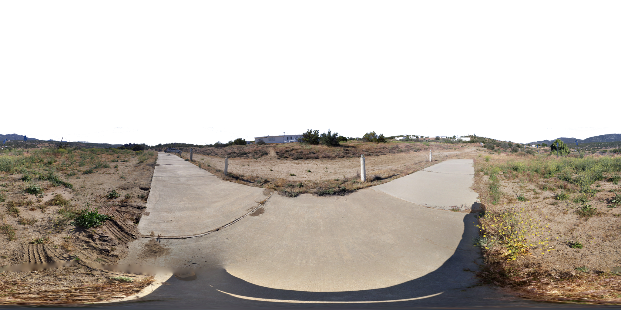
Panoramic file for Stellarium... This example was created from a full 360x180° "photo sphere". Note that the sky has been erased. 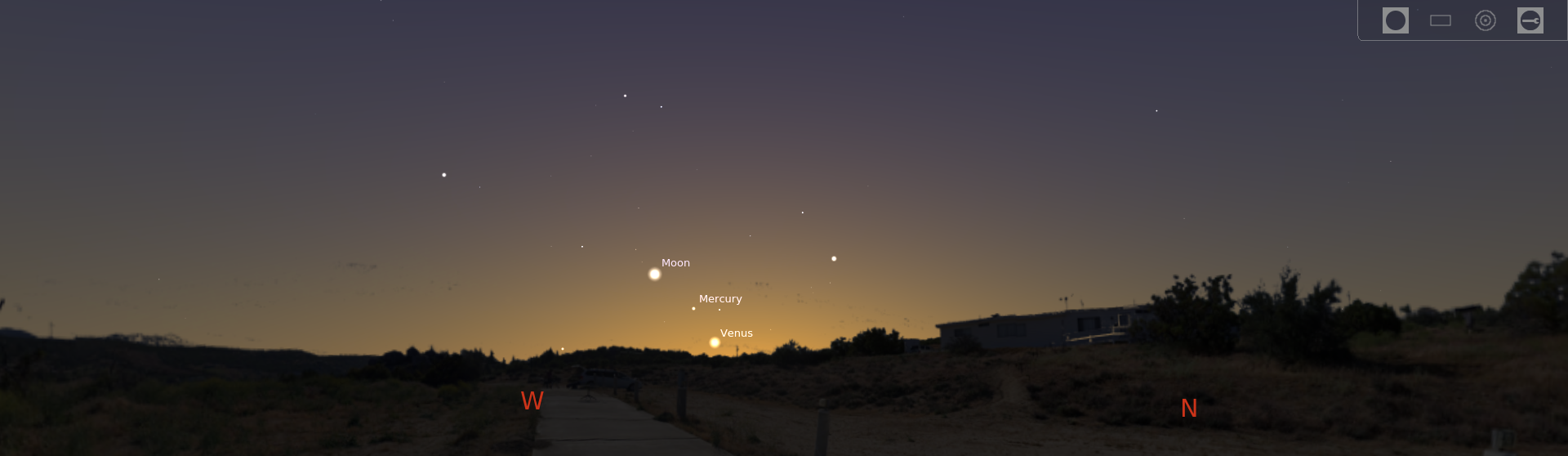
Example view from Stellarium using the landscape photo above. The "landscape.ini" text file contains information for Stellarium. Most of the parameters are obvious.
The parameter "angle_rotatez" may need to be tweaked depending on the compass direction of where the panoramic
photo right/left edges meet.
|
|