
Finding the Right Spot -- General Considerations
In theory, the eclipse crosses the entire continental U.S., making it an ideal situation for site selection. But especially for the photographic eclipse chaser wanting to capture a clear view of the entire 3 hour duration (1st to 4th contact) of the eclipse, we need to be a lot pickier about choosing a location.
If you’re not traveling with a commercial tour operator or someone else doing the planning, finding the right spot is a bigger deal than you may imagine. Although the eclipse path is thousands of miles long within a country where roads are generally good and you’ll have fewer safety concerns, there may be a lot of traffic, and ideal observing spots may be filled to capacity or may be on private property. Hotel accommodations near or inside the eclipse path have almost certainly been booked already and may have been for several years.
What follows is a general discussion of the factors I considered when doing reconnaissance along the eclipse path over the past two summers. Two trips were made in August 2015 and August 2016, covering some 8000 miles in total. My wife, Jean, played a big role in sharing the driving and photo recon chores as well as adapting our vehicle for camping, so I’m very grateful for her help!
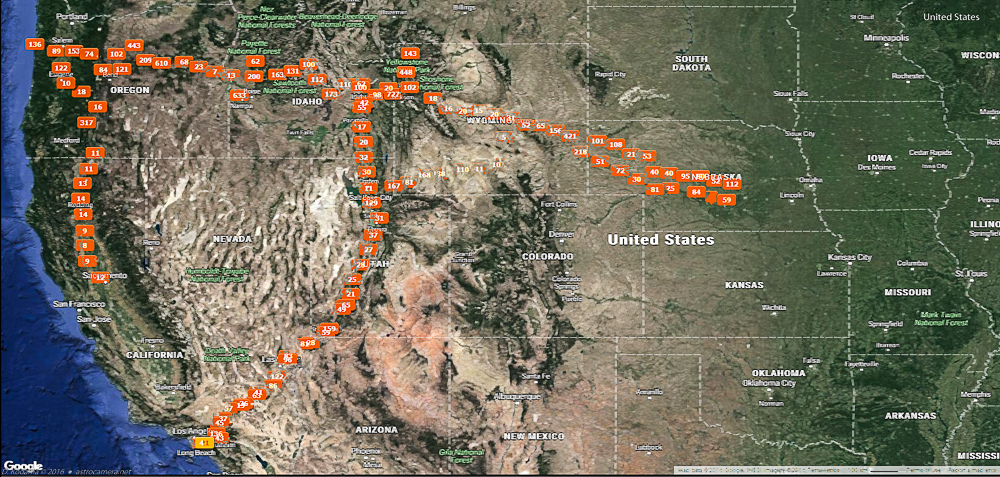
This plot of geo-located photos and videos (created in Lightroom) roughly shows the coverage of the two recon trips. In 2015, the route ran up I15 to Idaho Falls, east to the middle of Nebraska, then back down I15. In 2016, our route took us up I5 to Oregon, west to the coast, east to the Idaho-Wyoming border, then back down I15.
Based on historical weather records*, the western part of the U.S. seems to be a better bet for clear skies, so I’ve arbitrarily drawn my limit line at the Mississippi River. This does exclude the point of maximum duration of totality near Carbondale, IL, but we’re talking about trading off a few seconds of totality for better chances of clear weather.
Not only is this area closer to me (southern California), the eastern U.S. is more heavily populated, making it more likely to be difficult to find open, uncrowded areas to observe the eclipse. A denser population will also likely make it difficult to move quickly on a highway to adjust an observing position.
* Espenak, Anderson - Eclipse Bulletin: Total Solar Eclipse of 2017 August 21
Clouds
Weather is obviously a major factor in deciding upon a site, so you may be wondering about the definition of cloud cover. I am too. The definitive reference Eclipse Bulletin: Total Solar Eclipse of 2017 August 21 gives some statistics and graphs of the general cloud cover percentages at the time of the year when the eclipse will occur. But these are based on historical averages and are understandably vague about what cloud cover means. Our recon trips are a miniscule sampling of the sky at fixed times, not necessarily at the late morning times at which the eclipse will occur, so no general conclusions are possible there either.
Since I’ve been living in southern California for decades, I’ve become accustomed to having totally cloud-free days or perhaps just a few clouds in the distance, usually up against the mountains. But talking to locals on our recon trips seem to indicate that a clear day could mean that numerous puffy opaque clouds dot the sky, or only a high wispy layer of cirrus clouds are visible. In the former case, the eclipse could be partially or totally blocked if you have bad luck. In the latter case, you may see the eclipse, but because of the scattering of light by the high clouds, your view of the subtle corona may not be as good as it could be in a truly clear sky.
On top of that, many places with apparently clear skies are susceptible to airplane vapor trails which not only persist, but widen to significantly reduce the clear sky areas. All of this throws even more difficulty into picking a good viewing spot.
Wind
Wind did not appear to be a problem in any of the areas covered. However, it's still a good idea to prepare for windy conditions on eclipse day.
Fires
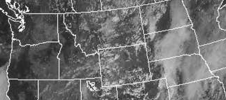
In the summer months, fires in the western U.S. are a major problem. Once the fires start, they can be burning for months, expanding practically without man-made containment, with smoke plumes miles long and often filling valleys with a choking haze. Rugged terrain forces firefighters to limit their efforts to protecting towns or infrastructure elements such as power lines. Extinguishing fires requires natural rainfall, in general. Satellite photos from 2016 show smoke plumes on the 2017 eclipse centerline.
Forests and Mountains
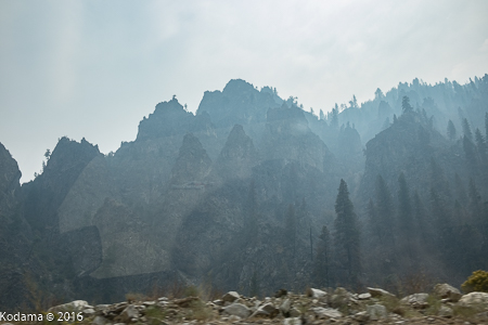
Forested and mountainous areas clearly need to be avoided. With tall trees, it’s obvious that finding an unobstructed view could be difficult. Add mountainous areas to the equation and this further reduces the chances of finding a suitable observing spot. The windward (usually tree-filled) sides of mountains generally force warm, humid air upwards to form clouds. Observing spots off the side of roads (e.g. rest stops or campgrounds) will tend to be in the valleys, restricting view of the sky even more. And if a nearby forest fire happens to be smoldering, the smoke is often channeled along the bottom of valleys.
Generally main mountain roads in the U.S. are very nicely maintained and typically allow 50+ mph travel. But they necessarily have curves and numerous uphill and downhill sections which limit mobility when you are trying to dash to your selected observing site. Side roads may provide more options, but they are often gravel or dirt and require 4-wheel drive off-road vehicles.
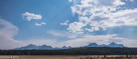
Mountain tops might seem a good bet since they generally rise above the lower haze and humidity of the surrounding countryside, but in reality, they need to be higher than most of the clouds, and that is not the case in the areas we’ve seen. Even if you were on top of Grand Teton in Wyoming (13,776 ft.) for this eclipse, there’s no guarantee that it would be above the surrounding clouds near noon when the eclipse occurs even though it seems to be clear in the mornings. Add the low probability of a high mountain to be at the center line, and lack of mobility in mountainous areas for a another thumbs-down rating.
The Great Plains
26 Aug. 2016
Given the above problems with forests and mountains, Wyoming and Nebraska may seem attractive for observing, but, as mentioned earlier, the reality is that the flat expanse of the Great Plains of the continent tend to be a superhighway for humid air from the Gulf of Mexico and/or arctic air from Canada. The combination of the two meeting in the middle make for a lot of dynamic weather. That’s great for storm chasers, but not for eclipse chasers. For the eclipse, we need calm, stable, clear conditions. This could happen in August, but during our August 2015 recon trip, we encountered more cloudy days (even rain) than we had hoped for. Still, August 21, 2017 could end up with weather that holds at least till mid-day when the eclipse occurs, so we are keeping that option open.
Narrowing the “Zone” -- Western end
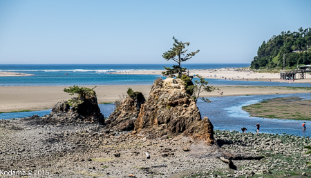
On the western end, coastal fog in Oregon is common, though when we passed there in August 2016, it was perfectly clear. Locals told us it was unusual, and probably due to drought conditions which have plagued Oregon for a few years. Another consideration is that the eclipse duration is shortened to less than 2 minutes as one gets closer to the coast.
A real problem for mobility along the coast is that US101 is the only way to travel along the coast. This is a narrow road which was congested under normal traffic conditions, and there is no way to travel inland along the center line. The nearest east-west routes require travel north or south substantially off the center line to access small roads, largely covered with trees when crossing the coastal range.
On the more optimistic side, the area between the coastal range and the Cascades might turn out to be a clear “hole” that is fine for casual eclipse viewing.
Narrowing the “Zone” -- Eastern end
On the eastern end of my “zone” are the Great Plains with the problems described above. Based on cloudy/rainy skies and increasing population density in eastern Nebraska, I ended my 2015 recon trip in central Nebraska. Note that the landscape in Nebraska is not completely flat. It consists of many rolling hills. At least on the western end, much of the countryside is used for livestock grazing, so it consists of short grass rather than forests or tall cornfields. If you end up in Nebraska, the a location at the top of a good hill might allow a nice view of the approaching or receding moon shadow.
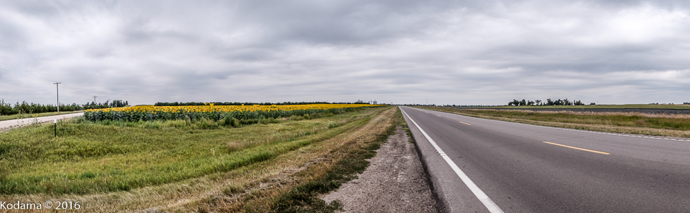
Typical Nebraska - essentially flat, a field of low crops (sunflowers), few trees, good roads, railroad track (right side), but cloudy skies.
What’s Left
What's left on the map is the area from the eastern side of the Oregon Cascade mountain range to just past the border of Wyoming and Nebraska. Below are photos and comments of selected areas from the recon trip, with focus on state parks, recreation areas, rest areas, and other places which may be suitable for observing the eclipse. Bear in mind, however, that many of these obvious areas will be targeted by other eclipse viewers, so having a set of alternate locations in mind would be a good "Plan B".
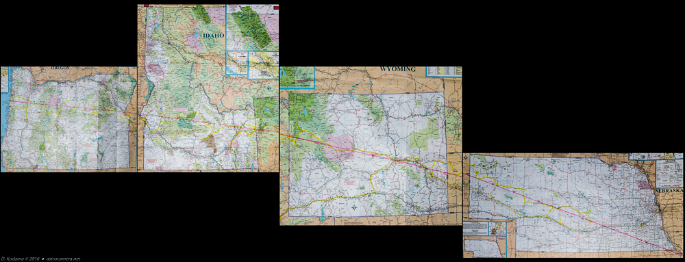
Route covered by recon trips in August 2015 and 2016. The eclipse center line is shown in pink. The driving path is highlighted in yellow on AAA (American Automobile Association) maps -- highly recommended because they are more detailed than Google Maps and a good backup for a failure of your electronics or poor cell phone connections.
For a closer look, see large images for Oregon, Idaho, Wyoming, and Nebraska.
Photos and Comments on Selected Areas ... work in progress...
The following areas are basically listed from west to east. Refer to the interactive map to see the locations listed. Most of the specific locations listed were chosen because they are clear of trees, flat, have parking, and (usually) restrooms. In some cases, they are just wide pull-out areas which could accommodate equipment setup. They may or may not be officially OK with the local authorities for the eclipse. You're on your own here!
On the map, click on the markers to see the approximate duration of totality as well as a link to the photos at tha location. Where possible, the photos are 360° panoramas. These will open in a separate browser window or tab.
-
- Pacific Coast
Not recommended due to normally foggy conditions, short eclipse duration, difficult to access. - Salem area
- Madras (north on US97) [360° View]
- John Day Fossil Beds Nat. Monument - Clarno
Not recommended - difficult to access, off center line. - John Day Fossil Beds Nat. Monument - Painted Hills [360° View]
- John Day Fossil Beds Nat. Monument - Sheep Rock
- Mascall Overlook [360° View]
- Strawberry Peak Viewpoint [360° View]
- Unity Lake State Park [360° View]
Oregon
- Pacific Coast
-
- Weiser (Oregon border)
- Mann Creek State Park [360° View]
- Arco
- Carnas National Wildlife Refuge
[360° View]
Not recommended due to single-lane, one-way, unpaved road. - Driggs, ID area [360° View] [More Photos]
Idaho
-
- Jackson, WY (Teton Range) [Photos]
- Fort Fetterman State Historical Site [Photos]
- Glendo State Park [360° View] [More Photos]
- Guernsey State Park [360° View #1] [360° View #2]
Wyoming
-
- Agate Fossil Beds National Monument [Photos]
Nebraska
Other Considerations
One of the concerns I had on my trips was cell phone coverage -- for internet access, which is essential to monitor the weather, fires, traffic and other changing conditions. Maps of cell phone coverage can be seen at OpenSignal.com, but the reality is that even the best networks have substantial holes if you go off the major highways (essentially, the interstate freeways). Travel through hilly terrain will make things worse. On the 2016 trip, I used a Google Fi phone which automatically switches between T-Mobil, Sprint, and U.S. Cellular, all of which were used, but there were still many areas wih no coverage. It's possible that using AT&T or Verizon could have improved things, but I'm skeptical about that in the mountainous areas. Nevertheless, it's worth considering a "temporary" Verizon or AT&T phone for the eclipse trip.
One more thing to remember for eclipse day... avoid the traffic jams and crowds!