|
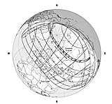
NASA eclipse track diagram.
|
The August 1, 2008 total solar eclipse started in northern Canada, cut across northern
Greenland and the North Atlantic, then continued through Siberia and Mongolia, terminating in
China.
|
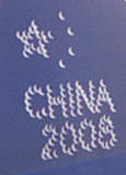
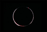
Primarily due to weather prediction considerations, we elected to travel to the Gobi Desert in
northern China where the air was driest and most likely to be clear for the eclipse. As it turned
out, we viewed the eclipse successfully, but it was an uncertain situation right down to the
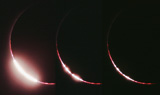
wire. The virtually cloudless wide angle view of the eclipse [right] hides
the fact that our observing site had to be changed at the last
minute and we had heavy cloud cover for virtually all of our 3-week trip to Asia,
which included Korea, China, and Mongolia.
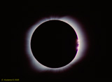
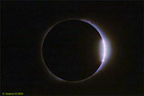
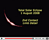
Considering the short length of this eclipse as well as the low angle of the eclipse (<15°
above the horizon at totality) with the associated risk of haze and cloud interference, I decided
concentrate on closeups of the 2nd and 3rd contacts and skip the long exposure sequences I did
for the 2006
eclipse in Libya.
|
|
|